Identifying a Mile Marker
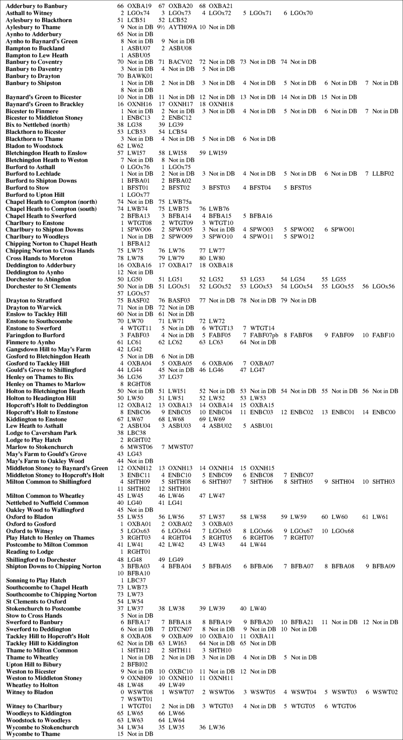
The Milestone Society identifies all mile markers in its database by means of a unique reference number, facilitating access to much recorded information. The following table may be used to find that number from the Oxfordshire historical map.
All road segments in the map which had mile markers in Victorian or later times (shown as red for ones still surviving, or as white-filled circles for ones lost), are indexed below in alphabetical order. To find which segment to refer to, look from the required mile marker along the decreasing mile numbers until a named junction, or destination (in capital letters), is met. This is the first name in the index entry below. Following the mile numbers in the other direction similarly leads to the second name in the index entry. The database reference is given alongside the mile number from the map.
Go back to the Oxfordshire historical map, or return to the map home page.