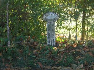
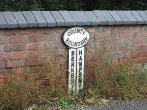
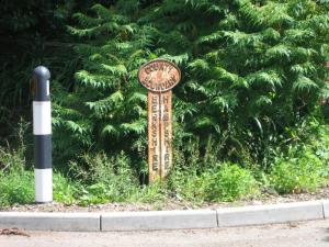
LL : Map Reference SU 3269 7030
On Leverton Lane to the north-west of Hungerford. At the western edge of Chilton Park, on the south side of the road. Legend BERKSHIRE-WILTSHIRE. Photo: P.Nelson, November 2006.
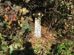
A4 : Map Reference SU 3054 6794
On the A4, west of Hungerford. Opposite a junction east of the Pelican Inn, close to a stepped footpath on the north side of the road. Legend WILTSHIRE-BERKSHIRE. Photo: P.Nelson, November 2006.
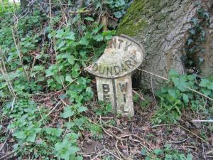
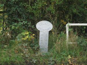
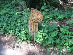
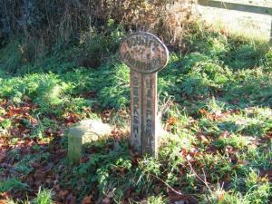
SR : Map Reference SU 3525 6333
On Spray Road east of Ham. At a corner at the eastern end of Lower Spray Copse, on the south side of the road. Legend BERKS...-WILTS... Part of the head is missing. Photo: P.Nelson, March 2007.
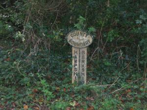
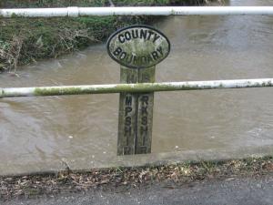
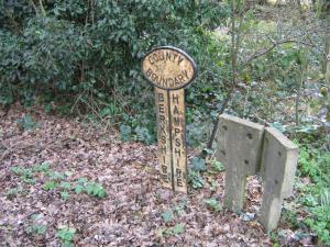
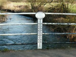
WC : Map Reference SU 3978 6205
On an unclassified road south-east of West Woodhay. Just north of a junction at the southern corner of Woodcut Copse, on the west side of the road. Legend HAMPSHIRE-BERKSHIRE. Photo: P.Nelson, October 2006.
BH : Map Reference SU 4117 6388
On an unclassified road north-west of Ball Hill. At the River Enborne crossing, on the west side of the road. Legend HAMPSHIRE-BERKSHIRE. Perhaps painted white when the railings were done. Photo: P.Nelson, October 2006.
GE : Map Reference SU 4186 6380
On an unclassified road north of Gore End. On Gore End Bridge over the River Enborne, on the east side of the road. Legend BERKSHIRE-HAMPSHIRE. Photo: P.Nelson, October 2006.
BF : Map Reference SU 4369 6341
On an unclassified road east of Ball Hill, near Bourne Farm. On the bridge over the River Enborne, on the south side of the road. Legend BERKSHIRE-HAMPSHIRE. Photo: P.Nelson, October 2006. More
AB : Map Reference SU 4901 6376
Close to the A339 road south of Greenham Common, on a road south towards Burghclere. On Aldern Bridge over the River Enborne, on the west side of the road. Legend HAMPSHIRE-BERKSHIRE. Photo: P.Nelson, February 2007. More
BC : Map Reference SU 5680 6283
On the B3051 at Brimpton Common at a junction with a bridleway on the south side of the road. Legend BERKSHIRE-HAMPSHIRE. Photo: P.Nelson, March 2007.
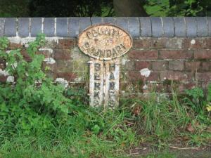
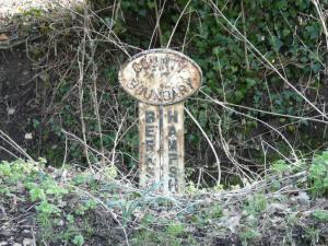
BR : Map Reference SU 5746 6240
On the Baughurst road running south-east from the B3051. At a junction half a mile along, on the north side of the road. Legend BERKSHIRE-HAMPSHIRE. Part of the head is missing. Photo: P.Nelson, July 2007.
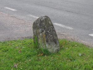
IS : Map Reference SU 6164 6252
The 'Imp Stone', reputedly a Roman mile stone, long used as a boundary stone marking a change in direction of the county boundary. Shown as 'Nimph Stone' on Rocque's map of 1761. On the north side of Silchester Road. No legend. Photo: P.Nelson, July 2007.
WR : Map Reference SU 6162 6404
On Welshman's Road at a junction west of Benyon's Inclosure, on the north side of the road. Legend BERKSHIRE-HAMPSHIRE. Photo: P.Nelson, July 2007. More
SL : Map Reference SU 6491 6425
Summerlug, south of Mortimer village, on the east side of Turk's Lane. Legend BERKSHIRE-HAMPSHIRE. Benchmarked boundary stone alongside, legend B/BRDC on Berks side, H/BRDC? on the other. Photo: P.Nelson, November 2007.
SC : Map Reference SU 7411 6340
On a bridge over the Whitewater River on School Lane, east of Riseley, on the north side of the road. A modern replica in chunky plastic/composite material. Legend BERKSHIRE-HAMPSHIRE. Photo: P.Nelson, February 2008.
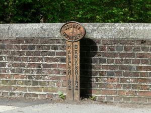
LC : Map Reference SU 7617 6280
South of a ford across the Blackwater River west of Lower Common village, on the east side of the road. Legend BERKSHIRE-HAMPSHIRE. Photo: P.Nelson, February 2008.
YB : Map Reference SU 8258 6146
On Yateley Bridge over the Blackwater River, between Sandhurst and Yateley, on the west side of the road. Legend HAMPSHIRE-BERKSHIRE. Photo: P.Nelson, April 2008.
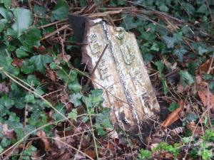
Wi : Map Reference SU 9252 6568
Near Windlesham, on the B3020 north of the A30 junction, on the east side of the road. Legend BERKS...-SURREY. Damaged remnant only. Photo: J.Nicholls, April 2008.
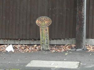
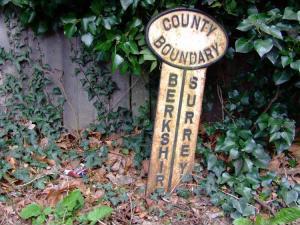
SH : Map Reference SU 9602 6751
50m into Bedford Lane from the A30 at Shrubs Hill, on the north side of the road. Legend BERKSHIRE-SURREY. Photo: P.Nelson, August 2008.
OW : Map Reference SU 9930 7334
Old Windsor, on the A328 at the junction with the B3021, on the east side of the road. Legend BERKSHIRE-SURREY. Photo: J.Nicholls, April 2008.
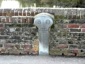
SB : Map Reference SU 7551 7576
On Sonning Bridge over the River Thames, on the south side of the road. A modern sculpted stone in 'lollipop' form. Legend B-O/COUNTY BOUNDARY 2001. Photo: P.Nelson, March 2009.